Contents
Overview
In late 2022, the University of Leeds was awarded funding for ‘Dial Moving Activities’ regarding a GreenSpace Research, Development and Innovation (RD&I) activity by the UK Space Agency (UKSA) on behalf of a consortium comprising the University of Edinburgh, the Spatial Finance Initiative, the UK Centre for Greening Finance and Investment (CGFI), and Space Hub Yorkshire. The funding is expected to:
- Establish new networks at the intersection of Space, Agricultural and Financial technology.
- Deliver industry-led research projects that tackle key challenges in the practical application of GreenSpace-enabled financial models.
- Raising the profile of GreenSpace technologies regionally and nationally.
The GreenSpace Project harnesses Space Hub Yorkshire’s development and leverages Yorkshire’s position at the heart of Green Finance in the UK to connect the adjacent industrial sectors of Space Technology, Green Finance, and Agriculture, and embed the use of Space technology as a tool for implementing Green Finance solutions. GreenSpace builds on Yorkshire’s existing position at the intersection of the Green Finance and Space industries, bringing together business and academic communities to develop a vibrant new network for the UK. GreenSpace provides support to these sectors through dedicated expert staff and academic excellence in order to unlock economic growth and enable world-class academic research in Yorkshire, the North of England, and across the UK.
Objectives
Catalyse additional investment into the space sector, with a particular focus on the agriculture and green finance industries.
This objective will lead to the growth of the space business community in Yorkshire. Successful completion is defined as 300 new companies joining our network, with 20 joining the Space Enterprise Network, and 20 new commercial partnerships.
Create and safeguard employment in Yorkshire.
With the growth of the space business community in Yorkshire and an increase in commercial partnerships will come an increase in employment and learning opportunities for the people of Yorkshire. Through the Yorkshire Pilot Study, an increase in investment across the space, agricultural, and financial sectors is anticipated, leading to more opportunities for the people of Yorkshire.
Facilitate collaborative research and development between academic and commercial partners.
By developing pilot and proof-of-concept projects, and increasing engagement with organisations currently outside of our network, we will facilitate the formation of new partnerships between industry and academia as well as cross-discipline partnerships. Successful completion of this objective is defined as producing six collaborative projects, winning three grant proposals with a goal of £3m in total, and 1 commercially funded project.
Raise awareness, both nationally and internationally of UK Space Sector capabilities.
Space Hub Yorkshire will produce a portfolio of high-quality promotional material to promote the region as a space hub and ongoing GreenSpace activities. Space Hub Yorkshire personnel will attend and support national and international space-related events to highlight the local space sector, its capabilities, and raise awareness of Yorkshire as a destination and partner for GreenSpace activities. Space Hub Yorkshire personnel will also support FDI and LEP/DIT investment campaigns to raise Yorkshire’s space sector profile.
Increase the number of space and non-space sector organisations engaging with the space sector and Space Hub Yorkshire.
Space Hub Yorkshire will increase the number of space and non- space sector organisations engaging with the cluster and wider community. Events combining the space, agriculture, and financial sectors will facilitate additional engagement, leading to progress in GreenSpace-related activities. Successful completion of this objective is defined as hosting 6 events across the project, with 250 organisations engaging with SHY and 50 organisations engaging with Space North.
Getting Involved
To be kept up to date with the latest GreenSpace news, events, and opportunities, click the button below to sign up to the mailing list.
You may unsubscribe from the mailing list at any time. If you would like to get involved in our ongoing or future projects, funding opportunities, or collaborate on an event, email [email protected].
Space Enterprise Community
The Space Enterprise Community platform from the UK Space Ecosystem, a collaboration between the Satellite Applications Catapult and the UK Space Agency (UKSA), is a space to connect, collaborate, innovate and access the latest news and events across the UK space sector. If you or your organisation isn’t already a member, you can join for free by clicking the button below.
Strategic Alignment
The GreenSpace project focuses on connecting national goals with local expertise and is very closely aligned to the UKSA’s 2022-2025 plan for combating climate change using space technology[1]. In Yorkshire, local authorities have recognised a climate emergency, and GreenSpace will use space data to help meet both local and national climate change goals in the UK. Space Hub Yorkshire is seeking to build upon the success of the local space cluster to grow and realise the full economic potential of the GreenSpace sector.
[1] https://www.gov.uk/government/publications/uk-space-agency-corporate-plan-2022-25
GreenSpace Brochure
The document below provides an introduction to the GreenSpace project and the concepts it is based upon, an overview of the current status of and opportunities for GreenSpace-related activity in the UK, and the opportunities for GreenSpace activity moving forward.

GreenSpace Supported Projects
Opportunities for Earth Observation to Support Insurance Comparison Providers
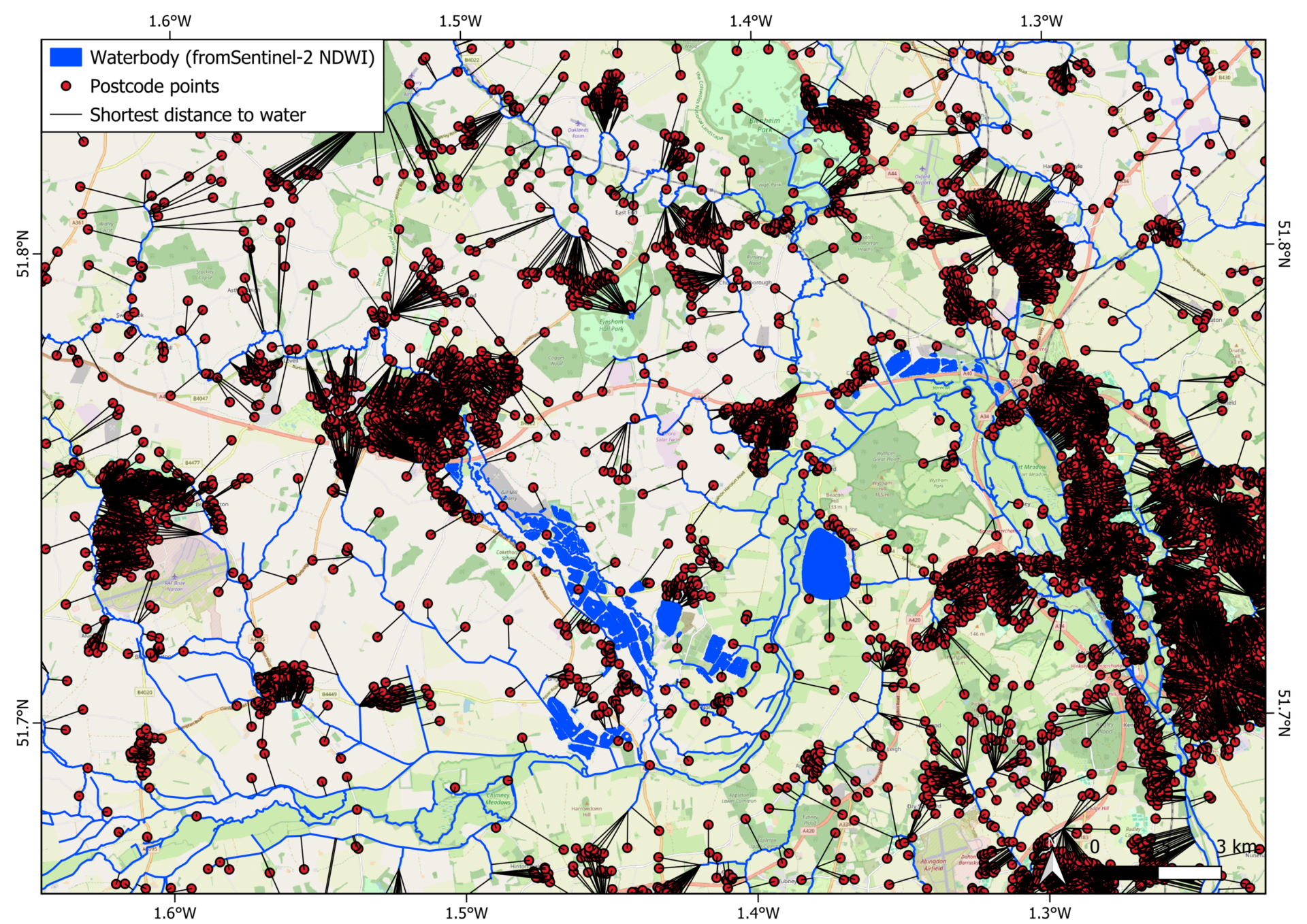
SHY, in collaboration with Go Compare, has piloted a project demonstrating how Earth observation data can enhance the insurance comparison market by assisting customers with home insurance queries. Using open-source Sentinel-2 imagery alongside the UK watercourse map, the project improves coverage of UK waterbodies.
By integrating free postcode data, GIS tools, and programming, a demo was developed to automatically calculate the shortest distance from a given postcode to the nearest waterbody. While highlighting the limitations of open-source geospatial data, the project shows that commercial datasets—such as detailed address information and tree distribution maps—can offer more precise insights for home insurance assessments. Click here to view the full report.
Barriers to Downstream Earth Observation Applications and Services and Impact of Interventions

SHY, in collaboration with Perspective Economics, is conducting a study into the barriers to downstream EO applications and services. The study consists of an in-depth analysis of the current state of the UK’s public and commercial EO market, an assessment of interventions by governments within the UK and abroad, and an extensive stakeholder engagement campaign via both online survey and live consultations.
The study, due to be completed in March 2025, will result in a report providing recommendations for addressing the barriers to EO adoption in the public and commercial sectors. The outputs will also include an in-depth cost-benefit analysis of potential future Government interventions.
EO Agri-Data Explorer App

EO data can be used to supplement ground measurements of farming activities, techniques, and aid in near real time assessments of, for example, crop and soil health, and water usage. However, it is not easy for an organisation that is new to using EO data to assess what data would be appropriate and whether the cost is worth the benefit for their organisation.
To allow organisations to independently assess the utility of EO data, GreenSpace has produced an app (EO Agri-Data Explorer) that allows a user to select a field within the UK and access time averaged or snapshot maps of agriculturally useful EO-derived indices and maps for free. The app uses Sentinel 2 data, processes it and clips the data to the boundaries of the field. The app is aimed as a learning and exploration tool, and the user guide refers users onwards to organisations and resources to further their exploration of EO data, broadening access. Click to access the app and user guide. The raw code can be accessed here.
Earth Observation Opportunities in Agricultural-Related Environmental Impact Reporting for the Financial Services Sector
SHY, in collaboration with Agtelligence, conducted a project to explore the potential for Earth Observation (EO) data to enhance climate-related reporting within financial institutions. The project involved a comprehensive analysis of the reporting requirements, both internal and external, of major financial institutions, as well as their long-term environmental monitoring and reporting goals.
Through desk-based research and one-on-one interviews, the project assessed the current use of EO data within the sector, identified opportunities for its future application, and highlighted the potential benefits for strengthening climate-related disclosures in line with the Task Force on Climate-Related Financial Disclosures (TCFD) framework. The findings were compiled into a report with actionable recommendations for optimally leveraging EO data to support financial institutions’ reporting needs.
Earth Observation Data Demonstrations for Local Climate Interests
The Yorkshire & Humber Climate Commission (YHCC) is an independent advisory body that brought together public, private, and third-sector organisations and individuals with the common goal of driving climate action in the Yorkshire and Humber region. Space Hub Yorkshire, through the GreenSpace project, developed proof-of-concept solutions based on satellite and geospatial data that could be used to support some of YHCC’s areas of interest and activity.
Three working demonstrations were produced:
– Remote detection of reintroduced beaver activity using free satellite data.
– Large-scale mapping of green vegetation to understand the region’s environment at scale and assess how climate change and regional interventions were affecting crops, forests, and grasslands.
– Large-scale coastline mapping to support long-term monitoring of coastal erosion.
Click here to view the full report.
Leveraging Earth Observation Imagery for Biodiversity Assessment in Food Production Systems
Typically, monitoring biodiversity on farmland is an expensive and labour-intensive activity. Agtelligence, a company focused on promoting sustainable agriculture practices through the use of Earth Observation (EO) technology, collaborated with Airbus Space and Defence to simplify this process. The GreenSpace team provided support to this Agtelligence-led project.
By combining AI and high-resolution satellite data, they aimed to streamline the monitoring of biodiversity. The project focused on assessing the quality of biodiverse habitats, particularly woody features, natural on-farm areas, and woodland patches, which are significant for UK farmland. These assessments were integrated into Agtelligence’s existing FarmScore® system, enhancing sustainability monitoring capabilities.
GreenSpace Landscape Review
GreenSpace Events
Past Events

GreenSpace Webinar Series #3: Applications of Satellite Data
This event was the third in the GreenSpace Webinar Series, which showcases the applications of satellite data in a variety of sectors. In this webinar, SHY gave an overview of the GreenSpace Project, followed by speakers from Oxford Sustainable Finance Group, LiveEO, and GHGSat.
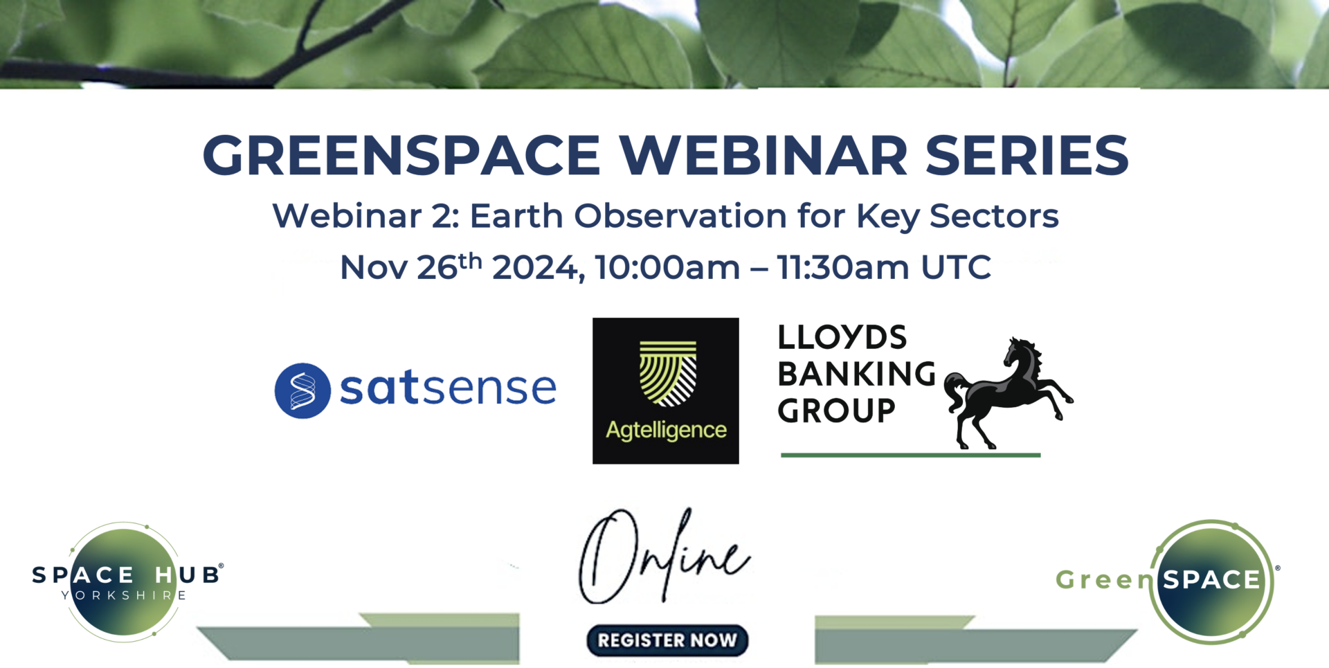
GreenSpace Webinar Series #2: Satellite Data for Key Sectors
This event was the second in the GreenSpace Webinar Series, which showcases the applications of satellite data in a variety of sectors. In this webinar, SHY gave an overview of the GreenSpace Project, followed by speakers from SatSense, Agtelligence, and Lloyds Banking Group all discussing the applications and requirements of EO data.

GreenSpace Webinar Series #1: Satellite Data in Action
This event was the first in the GreenSpace Webinar Series, which showcases the applications of satellite data in a variety of sectors. In this webinar, SHY gave an overview of the GreenSpace Project, followed by a showcase of three applications of satellite data from three industry experts.

Earth Observation for Sustainable Finance
Space Hub Yorkshire’s GreenSpace project and the Satellite Applications Catapult were excited to host Earth Observation for Sustainable Finance on April 17th 2024 in Nexus, Leeds. During this half-day event, we had fantastic speakers and panellists from the UK’s Centre for Greening Finance and Investment (CGFI), Virgin Money, Agtelligence, Verisk Maplecroft, and Deloitte, who talked about the challenges in sustainable finance and solutions that EO can provide.

Space Hub Yorkshire’s GreenSpace Project convened it’s first workshop on 23rd June 2023 at the Nexus Building in Leeds. The workshop was convened to engage individuals from GreenSpace-relevant sectors and to facilitate the development of R&D projects. Attendees included senior university academics and personnel from Earth Observation, agricultural, and financial organisations.
EO Agri-Data Explorer App
Click here to access the EO Agri-Data Explorer App.
Read below for a full user guide.